SULAWESI ISLAND
South Sulawesi – Central Sulawesi – North Sulawesi
Sulawesi – (formerly known as Celebes is an island in Indonesia. One of the four Greater Sunda Islands, and the world’s eleventh-largest island, it is situated between Borneo and the Maluku Islands.
Sulawesi comprises four peninsulas: the northern Minahasa Peninsula; the East Peninsula; the South Peninsula; and the South-east Peninsula. Three gulfs separate these peninsulas: the Gulf of Tomini between northern Minahasa peninsula and East Peninsula; the Tolo Gulf between East and Southeast Peninsula; and the Bone Gulf between the South and Southeast Peninsula. The Strait of Makassar runs along the western side of the island and separates the island from Borneo.
GEOGHRAPHY – Location in South Sulawesi, within Coordinates: 02°S 121°E, the Island is included of the Greater Sunda Islands, covering 174,600 km2 (67,400 sq mi), Sulawesi Island highest elevation is 3.478 m (11.411 Ft) within area rank is 11th. Highest point is Rantemario. One of the 5 main Island of Indonesia country, made this land is beeing the most strategic land in Indonesia, to connect between western side and eastern side of indonesia archipelago.
Nowadays Sulawesi Island is beeing to the one of the most favorites destination for travellers. Can start the journey of Sulawesi land from South Sulawesi – Makassar or begin it from Manado – North Sulawesi.
The population of Sulawesi land, approximately is : 18,455,058 (as of 2014 Estimate), spread out in several cities, and regencys such :
- West Sulawesi (Mamuju)
- North Sulawesi (Manado)
- Central Sulawesi (Palu)
- South Sulawesi (Makassar)
- South East Sulawesi (Kendari)
- Gorontalo (Gorontalo)
Within the densities are 97.4 /km2 (252.3 /sq mi), and the largest city is Makassar. Among the province, cities, region, there are ethnic groups living in the area who exist with their own habits and culture.
As mention below: Makassarese, Buginese, Mandar, Minahasa,Gorontalo, Toraja, Butonese, Bajau, Mongondow, and many other tribes still alive in the remotes sites of Sulawesi land.
Etymology – The Portuguese were the first to refer to Sulawesi as ‘Celebes’. The name ‘Sulawesi’ possibly comes from the words sula (‘island’) and besi (‘iron’) and may refer to the historical export of iron from the rich Lake Matanoiron deposits.
Geology – The island slopes up from the shores of the deep seas surrounding the island to a high, mostly non-volcanic, mountainous interior. Active volcanoes are found in the northern Minahassa Peninsula, stretching north to the Sangihe Islands. The northern peninsula contains several active volcanoes such as Mount Lokon, Mount Awu, Soputan, and Karangetang.
According to plate reconstructions, the island is believed to have been formed by the collision of terranes from the Asian Plate (forming the west and southwest), from the Australian Plate (forming the southeast and Banggai), and from island arcs previously in the Pacific (forming the north and east peninsulas). Because of its tectonic origin, several faults scar the land; as a result, the island is prone to earthquakes.
Sulawesi, in contrast to most of the other islands in Wallacea, is not truly oceanic, but a composite island at the centre of the Asia-Australia collision zone.Parts of the island were formerly attached to either the Asian or Australian continental margin and separated from these areas by vicariant processes. In the West, the openingof the Makassar Strait separated West Sulawesi from Sundaland in the Eocene c. 45 Mya. In the East, the traditional view of collisions of multiple micro-continental fragments sliced from New Guinea with an active volcanic margin in West Sulawesi at different times since the Early Miocene c. 20 Myna has recently been replaced by the assumption of extensional fragmentation following a single Miocene collision of the Sula Spurwith West Sulawesi.
NATIONAL PARK IN SULAWESI
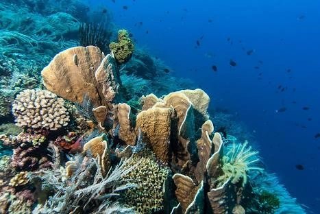
WALL REEF – BUNAKEN NATIONAL MARINE PARK
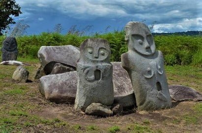
POKEKEA MEGALITHIC – LORELINDU NATIONAL PARK
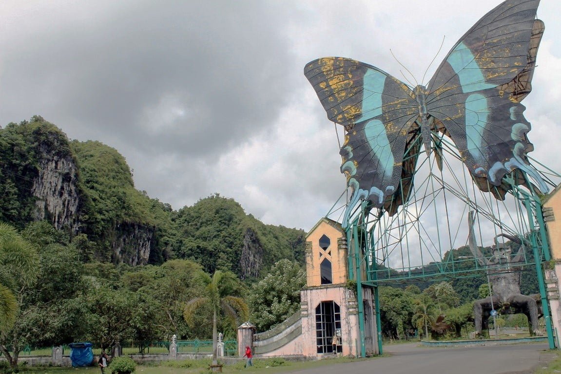
BANTIMURUNG NATIONAL PARK
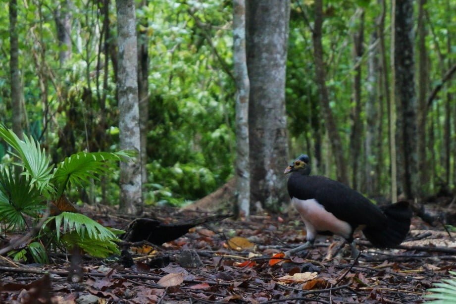
DUMOGA NANI WARTABONE NATIONAL PARK
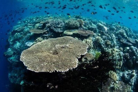
WAKATOBI NATIONAL MARINE PARK
Flora and fauna – Sulawesi is part of Wallacea, meaning that it has a mix of both Asian and Australasian species. There are 8 national parks on the island, of which 4 are mostly marine. The parks with the largest terrestrial area are Bogani Nani Wartabone with 2,871 km² and Lore Lindu National Park with 2,290 km². Bunaken National Park which protects a rich coral ecosystem has been proposed as an UNESCO World Heritage Site.
Conservation – The island was recently the subject of an Ecoregional Conservation Assessment, coordinated by The Nature Conservancy. Detailed reports about the vegetation of the island are available. The assessment produced a detailed and annotated list of ‘conservation portfolio’ sites. This information was widely distributed to local government agencies and nongovernmental organizations. Detailed conservation priorities have also been outlined in a recent publication.
The lowland forests on the island have mostly been removed. Because of the relative geological youth of the island and its dramatic and sharp topography, the lowland areas are naturally limited in their extent. The past decade has seen dramatic conversion of this rare and endangered habitat. The island also possesses one of the largest outcrops of serpentine soil in the world, which support an unusual and large community of specialized plant species. Overall, the flora and fauna of this unique center of global biodiversity is very poorly documented and understood and remains critically threatened..
Parks
The island of Sulawesi has six national parks and nineteen nature reserves. In addition, Sulawesi has three marine protected areas. Many of Sulawesi’s parks are threatened by logging, mining, and deforestation for agriculture.
Here the following are the National Parks on Sulawesi Island.
- Bantimurung-Bulusaraung National Park. – South Sulawesi
- Bogani Nani Wartabone National Park. – North Sulawesi.
- Bunaken National Park. – North Sulawesi
- Togean Islands National Park. – Central Sulawesi
- Wakatobi National Park. – South East Sulawesi
- Lore Lindu National Park. – Central Sulawesi
- Aopa Watumohai Swamp National Park. – South East Sulawesi.
- Taka Bone Rate National Park – South East Sulawesi
HOW TO GET THERE?
International Flights
From Abroad, Sulawesi Island is reachable from Singapore to Makassar by Silk air and Garuda airlines. Also from Malaysia by Air Asia to Makassar. And the other flights is fly to Manado operating by Silk air from Singapore within 4 times in a week. As one of the biggest Island in Indonesia Sulawesi Island also, reachable by the sea, is easy to move from and other places in Indonesia from this land.
Domestic Flights
Almost all of commercial flights is serve to Sulawesi Island covering Jakarta, Denpasar, Surabaya, Balikpapan, fly to Makassar or Manado. Makassar and Manado is an entry point to Eastern Indonesia and from those two airports passenger conect the flights to several airport in Eastern Indonesia such as : Sorong, Jayapura, Ternate, Ambon, Palu, Gorontalo, Luwuk, and the airline who serve the line are :
- Lion air
- Batik air
- Garuda Indonesia Airlines
- Sriwijaya air
- Wings air
- Airfast
Quotes :
- We are happy to create you a memorable tours in Sulawesi island.
- We can create you a tour program according to your needs and budget
- Do not hesitated to get more information through our contact form below
